A STORY ABOUT EXPLOITATION

SECAUCUS HISTORIC MAP
The first dutch settlement of what will be called Sikakes lied on a ridge emerging from the surrounding tidal marsh. The former name came from two Algonquian words; seke or sukit, meaning black; achgook, meaning snakes nest. Indeed the only ideal place for the natives was Snake Hill (as well known as Laurel Hill) and the boundaries, because the meadows were inhospitable, although full and rich of wild life. The aborigines were the Leeni-Lenape, a Indian sub-tribe. For they were roving people, used to hunt and fish in the area and to live in wigwans, in which sides corn was planted. The Dutch coloners instead establish their houses in 18th century, where the plank road connecting Hoboken to Paterson was being built.

SECAUCUS ORTOPHOTO – 1930

SECAUCUS ORTOPHOTO – 1977
The town grew on the ridges of the relief soaring from the swamp, even in the 30s a wide tidal plan used to divide Snake Hill and the town. During 70s started the industrial and commercial expansion, claiming the marshes along the actual Enterprise Ave. A strong zoning gave to that area a massive industrial and commercial connotation, devouring most of the remaining free lands.


OPERATIONAL PROPOSALS FOR A NEW WATER SYSTEM

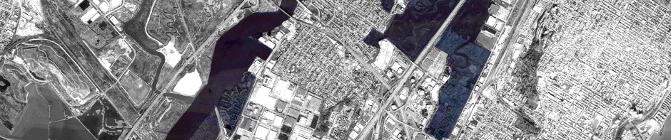
SECAUCUS – INFRARED 2012

WATER SYSTEM – ACTUAL SITUATION

WATER SYSTEM – PROPOSAL


