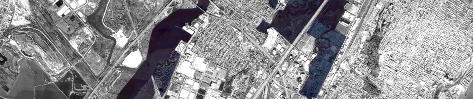
INFRASTRUCTURAL NARRATIVE

The land where Secaucus lies was purchased in 18th century by the dutch coloners, who established their houses where the plank road connecting Hoboken to Paterson was being built. Its trace was a former Indian trail connecting the Hudson river to the Great Falls, and indeed the road happens to be the longest plank road in New Jersey. Nowadays its role is taken by modern infrastructures, which relegated the historical urban spine to a secondary importance. But still the whole history hidden beneath its miles has not to be underestimated. Walkscapes for Secaucus tries to start a new narrative within the heritage traced by the infrastructural history of Secaucus.
WALKING AS NOMADIC OBSERVATORY
“On foot establishes an unmediated experience, allowing for a more dynamic reading of landscape. A nomadic research, a mode of capturing the act of crossing without regimentation, ratification and definition of the object” [from STALKER MANIFESTO]

TRAIL PROPOSAL
Crossing territories is conceived as a creative act, able to put in being a system of relationships. Walking is proposed as a form of inclusive mode of transportation. Anyone can use it without any additional element but his own feet. Walking is an urban practise in which the user takes his time to improve his awareness of the inhabited context.
The trail gives the chance first of all for an accessibility to the waterfront of the Hackensack River. In this way it gives a new frontier and orientational element for the whole city. Secondly it’s designed to interact with tidal dynamics, which determines temporary and resilient landscapes according to the level of the water.

TRAIL SECTION – WATERFRONT

TRAIL SECTION – PROTECTION FROM THE PARKWAY
The trail crosses different strategic places all along the coast, and eventually it distances from it, to creep the river. In this way beside connecting places all along the the Hackensack, the walker enters directly in contact with the water element, and even just by sight is allowed to make his own statement on the dynamics ongoing. Frequent walkers would develope an accumulation of data, imagery and knowledge by every step. As well the experience is opened to any sensorial perception. Each segment of the trail offers different microclimatic conditions, according to concurring contextual elements.


RECOVERING AN INFRASTRUCTURAL HERITAGE
 The trail uses modes of construction inherited from the history. It is conceived as a pedestrian plank road. The main purposes are:
- reusing a cultural background of former urban practise, in a way to implement historical and cultural issues in daily gestures.
- avoiding to alienate the walker to the ground he stomps. the terrain is not fully covered, allowing to still experience the terrain the trail crosses.
- avoiding to alienate as well the terrain from natural cycles, processes and phenomena.
- giving the chance for open structured editable paths and participation on tracing new traces.
The trail will run within and improve the existent activities ongoing already, embodying a spine along which these activities can find spaces and even more potentialities.

